AI restores James Webb telescope’s crystal-clear vision

Two PhD students from Sydney have helped restore the sharp vision of the world’s most powerful space observatory without ever leaving the ground. Louis Desdoigts, now a postdoctoral researcher at Leiden University in the Netherlands, and his colleague Max Charles celebrated their achievement with tattoos of the instrument they repaired inked on their arms — an enduring reminder of their contribution to space science.

A Groundbreaking Software Fix

Researchers at the University of Sydney developed an innovative software solution that corrected blurriness in images captured by NASA’s multi-billion-dollar James Webb Space Telescope (JWST). Their breakthrough restored the full precision of one of the telescope’s key instruments, achieving what would once have required a costly astronaut repair mission.

This success builds on the JWST’s only Australian-designed component, the Aperture Masking Interferometer (AMI). Created by Professor Peter Tuthill from the University of Sydney’s School of Physics and the Sydney Institute for Astronomy, the AMI allows astronomers to capture ultra-high-resolution images of stars and exoplanets. It works by combining light from different sections of the telescope’s main mirror, a process known as interferometry. When the JWST began its scientific operations, researchers noticed that AMI’s performance was being affected by faint electronic distortions in its infrared camera detector. These distortions caused subtle image fuzziness, reminiscent of the Hubble Space Telescope’s well-known early optical flaw that had to be corrected through astronaut spacewalks.

Solving a Space Problem from Earth

Instead of attempting a physical repair, PhD students Louis Desdoigts and Max Charles, working with Professor Tuthill and Associate Professor Ben Pope (at Macquarie University), devised a purely software-based calibration technique to fix the distortion from Earth.

Their system, called AMIGO (Aperture Masking Interferometry Generative Observations), uses advanced simulations and neural networks to replicate how the telescope’s optics and electronics function in space. By pinpointing an issue where electric charge slightly spreads to neighboring pixels — a phenomenon called the brighter-fatter effect — the team designed algorithms that digitally corrected the images, fully restoring AMI’s performance.

“Instead of sending astronauts to bolt on new parts, they managed to fix things with code,” Professor Tuthill said. “It’s a brilliant example of how Australian innovation can make a global impact in space science.”

Sharper Views of the Universe

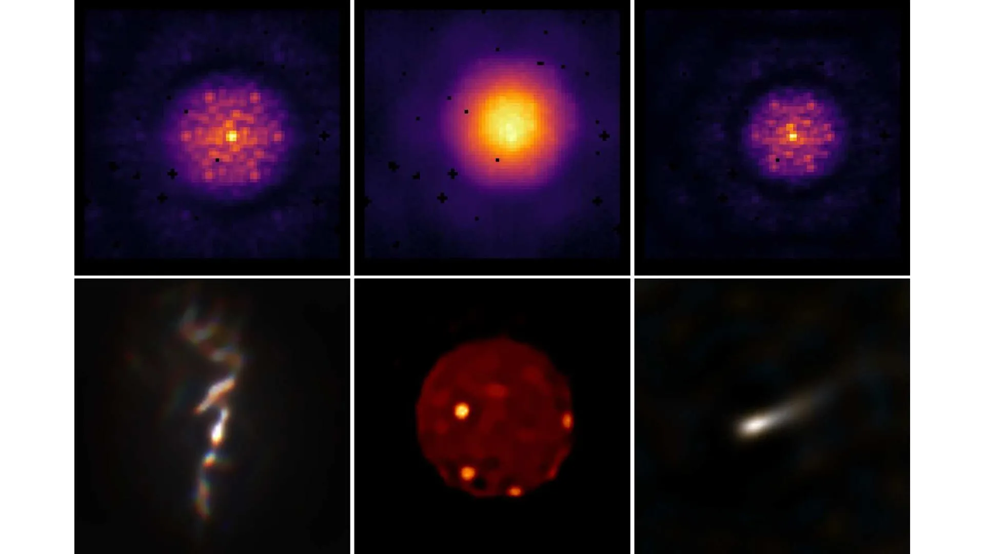
The results have been striking. With AMIGO in use, the James Webb Space Telescope has delivered its clearest images yet, capturing faint celestial objects in unprecedented detail. This includes direct images of a dim exoplanet and a red-brown dwarf orbiting the nearby star HD 206893, about 133 light years from Earth.

A related study led by Max Charles further demonstrated AMI’s renewed precision. Using the improved calibration, the telescope produced sharp images of a black hole jet, the fiery surface of Jupiter’s moon Io, and the dust-filled stellar winds of WR 137 — showing that JWST can now probe deeper and clearer than before.

“This work brings JWST’s vision into even sharper focus,” Dr. Desdoigts said. “It’s incredibly rewarding to see a software solution extend the telescope’s scientific reach — and to know it was possible without ever leaving the lab.”

Dr. Desdoigts has now landed a prestigious postdoctoral research position at Leiden University in the Netherlands.

Both studies have been published on the pre-press server arXiv. Dr. Desdoigts’ paper has been peer-reviewed and will shortly be published in the Publications of the Astronomical Society of Australia. We have published this release to coincide with the latest round of James Webb Space Telescope General Observer, Survey and Archival Research programs.

Associate Professor Benjamin Pope, who presented on these findings at SXSW Sydney, said the research team was keen to get the new code into the hands of researchers working on JWST as soon as possible.

Share Button

Hidden 5-mile wide asteroid crater beneath the Atlantic revealed in stunning 3D

Researchers from Heriot-Watt University have released striking images of an asteroid impact crater hidden deep beneath the floor of the Atlantic Ocean.

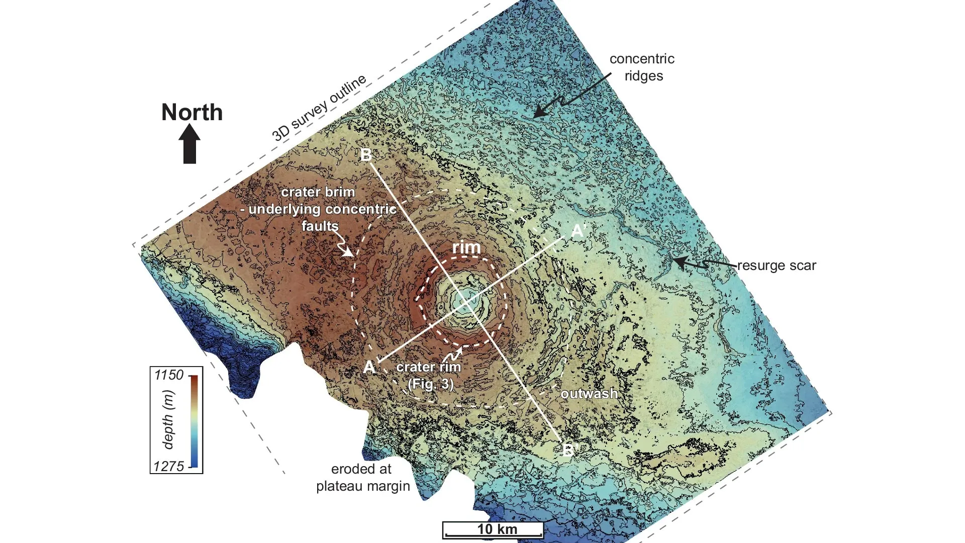
These images confirm that the 9 km (~5.6 mile) wide Nadir Crater, lying about 300 meters (~1000 feet) below the ocean floor, was created when an asteroid slammed into Earth roughly 66 million years ago at the end of the Cretaceous period.

The timing matches that of the Chicxulub impact in Mexico, the colossal 200 km (~125 mile) wide crater linked to the extinction of the dinosaurs.

Using the new data, scientists have pieced together what unfolded immediately after the Nadir impact: the crater initially formed as a deep bowl, molten rock surged upward from below, a vast zone of fractured rock spread outward for thousands of square kilometers, and an enormous tsunami more than 800 meters (~2600 feet) high swept across the Atlantic.

The research was published in Nature Communications Earth & Environment.

66 million-year-old underwater imprint

Dr. Uisdean Nicholson of Heriot-Watt University first identified the Nadir Crater in 2022 while examining seismic reflection data from the Atlantic seabed off the coast of Guinea in West Africa.

The data revealed a circular depression measuring more than 8.5 km across, leading Dr. Nicholson to suspect it was the site of an ancient asteroid strike.

He then collaborated with experts in planetary science and geology from the UK and the USA to analyze the evidence. Early results suggested the crater was formed by an asteroid several hundred meters wide about 66 million years ago, but proof remained uncertain.

That confirmation has now arrived.

From a grainy ultrasound to a 3D image

High-resolution, three-dimensional seismic data collected by the global geophysical company TGS and shared with Dr. Nicholson provides clear evidence that an asteroid created the Nadir Crater.

Dr. Nicholson said: “There are around 20 confirmed marine craters worldwide, and none of them has been captured in anything close to this level of detail. It’s exquisite.

“Craters on the surface are usually heavily eroded and we can only see what is exposed, whereas craters on other planetary bodies usually only show the surface expression.

“These data allow us to image this fully in three dimensions and peel back the layers of sedimentary rock to look at the crater at all levels.

“One way to understand it is to think about a pregnancy ultrasound. A few generations ago, the ultrasound would show a grainy blob. Now you can see the baby’s features in 3D, in incredible detail — including all the internal organs.

“We’ve gone from 2D, fuzzy imaging to amazing high-resolution imaging of the Nadir Crater.”

Data reveals minute-by-minute chaos after collision

Dr. Nicholson said: “The new images paint a picture of the catastrophic event.

“We originally thought the asteroid would have been around 400m wide. We now think it was 450-500m wide, because of the larger crater size as shown by the 3D data.

“We can tell it came from about 20-40 degrees to the northeast, because of spiralling thrust-generated ridges surrounding the crater’s central peak — those are only formed following a low-angle oblique impact.

“And we think it would have hit Earth at about 20 km per second, or 72,000 km per hour, although we still need to confirm this with a new set of impact models.”

Using the data, the scientists created a timeline of what happened in the seconds and minutes after impact.

Dr. Nicholson said: “After the impact and the central uplift forming, the soft sediments surrounding the crater flowed inwards towards the evacuated crater floor, creating a visible ‘brim’.

“The earthquake shaking caused by the impact appears to have liquefied the sediments below the seabed across the entire plateau, causing faults to form below the seabed.

“The impact was also associated with large landslides as the plateau margin collapsed below the ocean.

“As well as this, we see evidence for a train of tsunami waves going away from, then back towards the crater, with large resurge scars preserving evidence of this catastrophic event.”

A natural laboratory for asteroid impact research

Dr. Nicholson points out that humans have never witnessed an asteroid of this size crashing into Earth.

“The closest humans have come to seeing something like this is the 1908 Tunguska event, when a 50-meter asteroid entered Earth’s atmosphere and exploded in the skies above Siberia.”

“The new 3D seismic data across the whole Nadir Crater is an unprecedented opportunity to test impact crater hypotheses, develop new models of crater formation in the marine environment and understand the consequences of such an event.

“We’ve applied to IODP3, which is a new international drilling program, to drill into the seabed and recover cores from the crater. These will give us more information about the shock pressures experienced during impact, and the precise age and sequence of events that occurred after this event.”

Unlike the moon, Earth’s craters erode

Collaborator Dr. Sean Gulick of the University of Texas at Austin, USA, a geophysicist and expert on impact processes, noted: “3D seismic images of a fully-preserved impact crater are a fantastic research opportunity that can allow us to consider how impact processes and craters scale with the size of the impactor both for understand the evolution of the Earth, and other worlds.”

Collaborator Dr. Veronica Bray of the University of Arizona, an expert in impact cratering across the solar system, commented: “We see pristine impact craters on airless bodies like the Moon, but don’t have subsurface structural information.

“On the Earth, that is reversed: we have structural data from seismics, field mapping and drill cores, but the craters are usually very eroded at the surface.

“The new 3D seismic imaging of Nadir gives us both. It’s a startlingly good look at an impact crater!”

Could an asteroid this size hit Earth soon?

The rubble pile asteroid Bennu is around 400m in diameter. It is considered the most hazardous object in near-Earth orbit. According to NASA scientists, its total impact probability through the year 2300 is about 1 in 1,750 (or 0.057%). The researchers were also able to identify September 24, 2182, as the most significant single date in terms of a potential impact, with an impact probability of 1 in 2,700 (or about 0.037%)

Share Button

Melting ice is hiding a massive climate secret beneath Antarctica

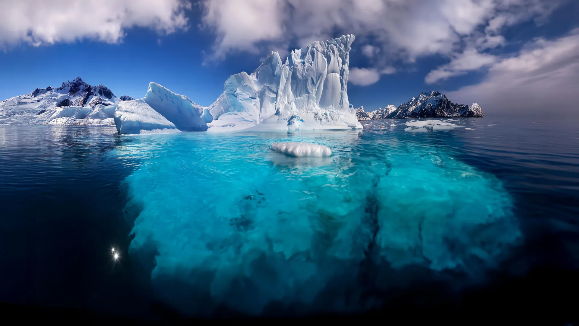
Climate models have long predicted that global warming would weaken the Southern Ocean’s ability to absorb carbon dioxide (CO2). Yet decades of measurements show little sign of this decline. Scientists from the Alfred Wegener Institute (AWI) have now uncovered a likely reason for the surprising stability. Their findings suggest that fresh, low-salinity water near the surface has helped trap carbon in the deep ocean, slowing its return to the atmosphere. But climate change is steadily altering these delicate ocean layers and could soon disrupt this natural carbon storage system. The study appears in Nature Climate Change.

Why the Southern Ocean Matters So Much

The world’s oceans capture roughly one quarter of all human-produced CO2 emissions. The Southern Ocean alone accounts for about 40 percent of that total, making it one of the planet’s most powerful natural defenses against global warming. This immense carbon sink functions through a complex circulation system: deep water rises to the surface, exchanges gases with the atmosphere, and then sinks again, carrying absorbed CO2 back into the depths.

The balance depends on how much natural CO2 from ancient deep waters resurfaces. When more carbon-rich water from below reaches the surface, it limits how much new, human-made CO2 the ocean can take in. This interplay is governed by the layering, or stratification, of different water masses and by the strength of ocean currents.

Ancient Waters and Strengthening Winds

The deep water that resurfaces in the Southern Ocean has been isolated for centuries or even millennia, accumulating large amounts of CO2. Climate models predict that stronger westerly winds, a result of human-driven climate change, will bring more of this carbon-rich water to the surface, reducing the ocean’s capacity to absorb CO2 in the long term.

However, despite these stronger winds, data collected over recent decades show that the Southern Ocean remains a strong carbon sink. The new AWI research helps explain why: ocean layering has changed in a way that keeps much of the deep carbon locked away.

The Invisible Barrier Holding Carbon Below

“Deep water in the Southern Ocean is normally found below 200 meters,” says Dr. Léa Olivier, AWI oceanographer and lead author of the study. “It is salty, nutrient-rich and relatively warm compared to water nearer the surface.”

This deep water contains large stores of dissolved CO2 that entered the ocean long ago. In contrast, near-surface water is cooler, less salty, and holds less CO2.

As long as this density layering remains strong, the CO2-rich deep water stays sealed off. But if the boundary between layers weakens, that trapped carbon could more easily reach the surface and escape into the atmosphere.

Stronger Winds, Rising Risks

“Previous studies suggested that global climate change would strengthen the westerly winds over the Southern Ocean, and with that, the overturning circulation too,” says Léa Olivier. “However, that would transport more carbon-rich water from the deep ocean to the surface, which would consequently reduce the Southern Ocean’s ability to store CO2.”

Although such wind intensification has been observed and linked to human activity, measurements still show no major decline in the ocean’s carbon uptake — at least not yet.

Freshwater Inputs Strengthen Ocean Layers

Long-term monitoring by AWI and other research institutions shows that climate change is already altering the characteristics of both surface and deep waters. “In our study, we used a dataset comprising biogeochemical data from a large number of marine expeditions in the Southern Ocean between 1972 and 2021. We looked for long-term anomalies, as well as changes in both circulation patterns and the properties of water masses. In doing so, we only considered processes related to the exchange between the two water masses, namely circulation and mixing, and not biological processes, for example,” explains Léa Olivier. “We were able to determine that, since the 1990s, the two water masses have become more distinct from one another.” The Southern Ocean’s surface water salinity has reduced as a result of increased input of freshwater caused by precipitation and melting glaciers and sea ice. This “freshening” reinforces the density stratification between the two water masses, which in turn keeps the CO2-rich deep water trapped in the lower layer and prevents it from breaking through the barrier between the two layers.

A Temporary Shield Against Climate Change

“Our study shows that this fresher surface water has temporarily offset the weakening of the carbon sink in the Southern Ocean, as model simulations predicted. However, this situation could reverse if the stratification were to weaken,” summarizes Léa Olivier. Strengthening westerly winds are already pushing the deep water closer to the surface. Since the 1990s, the upper boundary of the deep water layer has risen by about 40 meters.

As CO2-rich water replaces more of the surface layer, the boundary between them becomes more vulnerable to mixing, likely caused by those same winds. Once mixing increases, stored CO2 could begin to leak upward and escape into the atmosphere.

Warning Signs Beneath the Waves

Recent research suggests that this process may already be starting. If more carbon from the deep ocean reaches the surface, the Southern Ocean’s role as a global carbon sink could weaken, accelerating climate change.

“What surprised me most was that we actually found the answer to our question beneath the surface. “We need to look beyond just the ocean’s surface, otherwise we run the risk of missing a key part of the story,” says Léa Olivier.

“To confirm whether more CO2 has been released from the deep ocean in recent years, we need additional data, particularly from the winter months, when the water masses tend to mix,” explains Prof. Alexander Haumann, co-author of the study. “In the coming years, the AWI is planning to carefully examine these exact processes as part of the international Antarctica InSync program, and gain a better understanding of the effects of climate change on the Southern Ocean and potential interactions.”

Share Button

NHS needs £3bn to cover strikes, redundancies and drug costs, say health leaders

Health leaders say progress on reducing waiting lists will be affected if there is no help in making up the financial shortfall.

Share Button

We will not ‘be held to ransom’ by striking doctors, says minister

The health secretary is refusing to make concessions on pay after the BMA announced a further walkout.

Share Button

Ancient DNA reveals the deadly diseases behind Napoleon’s defeat

Scientists from the Institut Pasteur have conducted a genetic analysis of the remains of soldiers who retreated from Russia in 1812. Their work uncovered traces of two disease-causing pathogens — those behind paratyphoid fever and relapsing fever — which match the symptoms described in eyewitness records from that time. The findings were first shared as a preprint on bioRxiv on July 16, 2025, and later published in the journal Current Biology on October 24.

Investigating the Mystery of the 1812 Retreat

Napoleon’s invasion of Russia in 1812, known as the “Patriotic War of 1812,” ended in one of history’s most disastrous retreats. To better understand what role disease may have played in this collapse, researchers from the Institut Pasteur’s Microbial Paleogenomics Unit partnered with the Laboratory of Biocultural Anthropology at Aix Marseille University. The team analyzed the DNA of 13 French soldiers exhumed in 2002 from a burial site in Vilnius, Lithuania, uncovered during archaeological excavations led by the Aix-Marseille University group. Using next-generation sequencing technology on ancient DNA, they searched for genetic traces of infectious organisms.

The researchers detected two distinct disease agents: Salmonella enterica subsp. enterica (serovar Paratyphi C), which causes paratyphoid fever, and Borrelia recurrentis, the bacterium responsible for relapsing fever. The latter is transmitted by lice and produces alternating periods of fever and recovery. Although different, both infections can cause severe fever, exhaustion, and digestive distress. Their combined impact could have intensified the soldiers’ suffering at a time when cold, hunger, and poor sanitation were already taking a heavy toll.

Genetic Evidence From Napoleonic Soldiers

Out of the 13 soldiers examined, DNA from S. enterica Paratyphi C was found in four individuals, and B. recurrentis was detected in two. This marks the first direct genetic confirmation that these pathogens were present in Napoleon’s army. Their exact contribution to the enormous death toll remains uncertain, but the findings complement earlier research that identified Rickettsia prowazekii (the cause of typhus) and Bartonella quintana (responsible for trench fever), both long suspected of spreading through the ranks during the retreat.

Because only a small number of samples could be analyzed compared to the thousands of remains in Vilnius, researchers cannot yet determine how widespread these infections were. The tested soldiers represent a tiny fraction — 13 out of more than 3,000 bodies at the site and roughly 500,000 to 600,000 troops who took part in the campaign, of whom about 300,000 died during the retreat.

Understanding the Past to Protect the Future

“Accessing the genomic data of the pathogens that circulated in historical populations helps us to understand how infectious diseases evolved, spread and disappeared over time, and to identify the social or environmental contexts that played a part in these developments. This information provides us with valuable insights to better understand and tackle infectious diseases today,” explains Nicolás Rascovan, Head of the Microbial Paleogenomics Unit at the Institut Pasteur and last author of the study.

To achieve these results, the team worked in collaboration with scientists from the University of Tartu in Estonia to develop an innovative authentication workflow involving several steps, including a phylogeny-driven interpretive approach for the highly degraded genome fragments recovered. This method enables scientists to accurately identify pathogens even if their DNA only yields low coverage, in some cases even indicating a specific lineage.

“In most ancient human remains, pathogen DNA is extremely fragmented and only present in very low quantities, which makes it very difficult to obtain whole genomes. So we need methods capable of unambiguously identifying infectious agents from these weak signals, and sometimes even pinpointing lineages, to explore the pathogenic diversity of the past,” he adds.

Linking History and Disease

The team’s results closely match the historical descriptions of the fevers that swept through Napoleon’s forces. This connection strengthens the theory that infectious diseases contributed to the disastrous outcome of the 1812 campaign, along with other factors such as exhaustion, starvation, and the brutal Russian winter.

Napoleon’s 1812 campaign ultimately ended in defeat, forcing a massive withdrawal that devastated his army. The Russian forces reclaimed Moscow, marking a turning point that dealt a fatal blow to Napoleon’s military ambitions.

Share Button

Willpower doesn’t exist. Why so much of your health isn’t your fault

Dr Xand and Dr Chris van Tulleken share four small but powerful tips they’ve learnt over the course of 30 episodes.

Share Button

Scientists launch $14.2 million project to map the body’s “hidden sixth sense”

How does your brain know when to take a breath, stabilize your blood pressure, or fight off an infection? The answer lies in interoception, a lesser-known process through which the nervous system constantly monitors the body’s internal signals to keep essential functions running.

Now, a collaborative team from Scripps Research and the Allen Institute has received the National Institutes of Health (NIH) Director’s Transformative Research Award to develop the first comprehensive atlas of this internal sensory system.

A Major Investment in Brain-Body Research

Leading the project is Nobel Prize-winning neuroscientist Ardem Patapoutian, joined by Li Ye, the N. Paul Whittier Chair in Chemistry and Chemical Biology at Scripps Research, and Bosiljka Tasic, Director of Molecular Genetics at the Allen Institute. Xin Jin, Associate Professor at Scripps Research, will serve as co-investigator, directing the genomic and cell-type identification work.

The NIH has awarded the team $14.2 million over five years to carry out this ambitious project.

“My team is honored that the NIH is supporting the kind of collaborative science needed to study such a complex system,” says Patapoutian, the Presidential Endowed Chair in Neurobiology at Scripps Research.

Patapoutian, who shared the 2021 Nobel Prize in Physiology or Medicine for his discovery of cellular sensors that detect touch, will now apply his expertise to understanding interoception.

“We hope our results will help other scientists ask new questions about how internal organs and the nervous system stay in sync,” adds Ye. Like Patapoutian, he’s also a Howard Hughes Medical Institute Investigator.

Established in 2009, the Transformative Research Award funds groundbreaking interdisciplinary projects that push beyond traditional scientific boundaries. It is part of the NIH Common Fund’s High-Risk, High-Reward Research Program, designed to support innovative ideas that could reshape our understanding of human health but might otherwise struggle to receive funding through conventional mechanisms.

What Makes Interoception Unique

Unlike the classic senses — such as smell, sight, and hearing — which rely on specialized sensory organs that detect stimuli from the outside world, interoception involves a vast network of neurons that sense what’s happening inside the body. These neural circuits track critical processes including circulation, digestion, and immune activity.

Because interoceptive signals originate deep within the body and are often processed unconsciously, scientists often describe this system as our “hidden sixth sense.”

Despite its fundamental role, interoception has received little scientific attention. The signals it produces are complex, overlapping, and difficult to measure. The sensory neurons that carry them are distributed throughout organs such as the heart, lungs, stomach, and kidneys, making them hard to isolate and map precisely.

Mapping the Brain-Body Connection

With the NIH’s support, the Scripps and Allen Institute researchers plan to map how sensory neurons connect with a wide variety of internal organs, including the heart and gastrointestinal tract. Their goal is to create a detailed anatomical and molecular atlas that reveals how these neural pathways are organized.

To achieve this, one part of the project will label sensory neurons and use whole-body imaging to trace their routes from the spinal cord to different organs, producing a high-resolution 3D map. The second part will use genetic profiling to distinguish between different cell types, such as neurons that send signals from the gut, bladder, or fat tissue.

Together, these datasets will form the first standardized reference for understanding the body’s internal sensory wiring.

Why Interoception Matters for Health

By decoding how interoception works, scientists hope to uncover key principles of brain-body communication that could lead to new treatments for disease. Disruptions in these internal sensory pathways have been linked to a range of conditions, including autoimmune disorders, chronic pain, neurodegenerative diseases, and high blood pressure.

“Interoception is fundamental to nearly every aspect of health, but it remains a largely unexplored frontier of neuroscience,” says Jin, who’s a Howard Hughes Medical Institute Freeman Hrabowski Scholar. “By creating the first atlas of this system, we aim to lay the foundation for better understanding how the brain keeps the body in balance, how that balance can be disrupted in disease and how we might restore it.”

Share Button

Earth is splitting open beneath the Pacific Northwest

For the first time, scientists have directly witnessed a subduction zone — the place where one tectonic plate plunges beneath another — in the midst of breaking apart. The finding, published in Science Advances, provides an unprecedented view of how Earth’s surface changes over time and adds new insight into the potential for future earthquakes in the Pacific Northwest.

Subduction zones are some of the most powerful and dynamic features on Earth. They move continents across the globe, trigger massive earthquakes and volcanic eruptions, and recycle the planet’s crust deep into the mantle.

However, these zones are not permanent. If they never ended, continents would continuously collide and merge, erasing oceans and much of the planet’s geological history. For decades, scientists have wondered how these colossal systems eventually come to an end.

“Getting a subduction zone started is like trying to push a train uphill — it takes a huge effort,” said Brandon Shuck, a geologist at Louisiana State University and lead author of the study. “But once it’s moving, it’s like the train is racing downhill, impossible to stop. Ending it requires something dramatic — basically, a train wreck.”

Capturing a Subduction Zone in the Act

Off the coast of Vancouver Island, in the Cascadia region, scientists have now seen that “train wreck” unfolding. Here, the Juan de Fuca and Explorer plates are slowly sliding beneath the North American plate, and new data show the system is literally tearing itself apart.

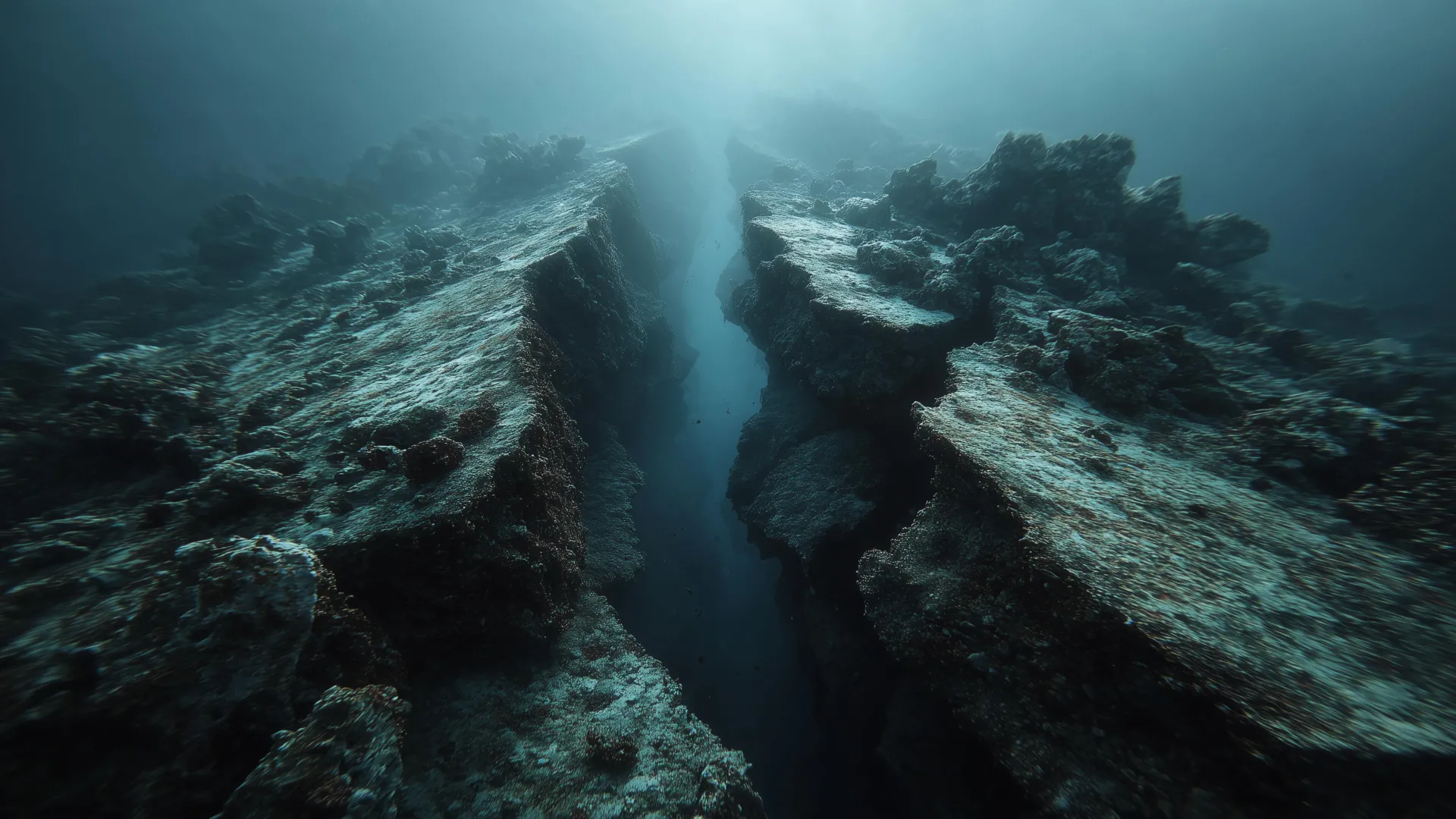
Researchers used seismic reflection imaging — essentially an ultrasound of Earth’s interior — combined with detailed earthquake records to observe the process. The data were gathered during the 2021 Cascadia Seismic Imaging Experiment (CASIE21), funded by the National Science Foundation. During the expedition, sound waves were sent from a research vessel into the seafloor and the returning echoes were captured by a 15-kilometer-long line of underwater sensors. The resulting images revealed deep fractures where the oceanic plate is snapping apart.

“This is the first time we have a clear picture of a subduction zone caught in the act of dying,” said Shuck. “Rather than shutting down all at once, the plate is ripping apart piece by piece, creating smaller microplates and new boundaries. So instead of a big train wreck, it’s like watching a train slowly derail, one car at a time.”

A Plate Coming Apart Piece by Piece

The team found enormous tears running through the oceanic plate, including a major offset where one section has dropped about five kilometers. “There’s a very large fault that’s actively breaking the plate,” Shuck explained. “It’s not 100% torn off yet, but it’s close.”

Earthquake data supported what the images showed. Along the 75-kilometer tear, some parts remain seismically active, while others have fallen silent. “Once a piece has completely broken off, it no longer produces earthquakes because the rocks aren’t stuck together anymore,” Shuck explained. The absence of quakes in certain areas suggests that sections of the plate have already detached, and the gap is gradually widening over time.

The study revealed that subduction zones don’t fail in one catastrophic break but die in stages, through a process known as “episodic” or “piecewise” termination. Instead of the entire plate snapping at once, it tears apart in smaller sections. Transform boundaries — the faults where plates slide past each other — act like natural scissors, slicing across the plate and isolating fragments that form new microplates while subduction continues nearby.

As the larger plate loses pieces, it also loses momentum. Like cutting cars off a runaway train, each break reduces the downward pull until the entire subduction process grinds to a halt. Although each episode takes millions of years, these gradual stages together mark the death of a subduction zone.

Clues to Earth’s Ancient Tectonic Mysteries

This slow breakup helps explain puzzling features from Earth’s past, such as abandoned fragments of old tectonic plates and bursts of volcanic activity in unexpected places. One striking example lies off Baja California, where scientists have long known of fossil microplates — the remnants of the once-vast Farallon plate. For years, researchers suspected these fragments were evidence of dying subduction zones, but the exact mechanism was unclear. The Cascadia region now offers a direct look at how that process happens: through step-by-step tearing, not sudden collapse.

The breakup of a plate doesn’t just stop motion — it reshapes the planet. As each fragment detaches, it can open “slab windows” where hot mantle material rises toward the surface, creating bursts of volcanic activity. Over time, new microplates form, old ones drift, and the boundaries shift again. “It’s a progressive breakdown, one episode at a time,” said Shuck. “And it matches really well with what we see in the geologic record, where volcanic rocks get younger or older in a sequence that reflects this step-by-step tearing.”

Earthquake Hazards and Future Research

Looking forward, scientists are investigating whether a major earthquake could rupture across one of these newly formed tears or if the fractures might alter how seismic energy moves through the region. While this discovery improves models of how complex fault systems behave, it does not significantly change the short-term risk for the Pacific Northwest.

Cascadia remains capable of generating very large earthquakes and tsunamis. Understanding how these newly identified breaks influence future ruptures will help refine hazard assessments and deepen our understanding of how Earth’s most powerful geological engines ultimately come to rest.

Share Button

Parents urged to vaccinate children over half-term as flu cases rise

Flu season has come early and cases are rising among children, NHS England says.

Share Button